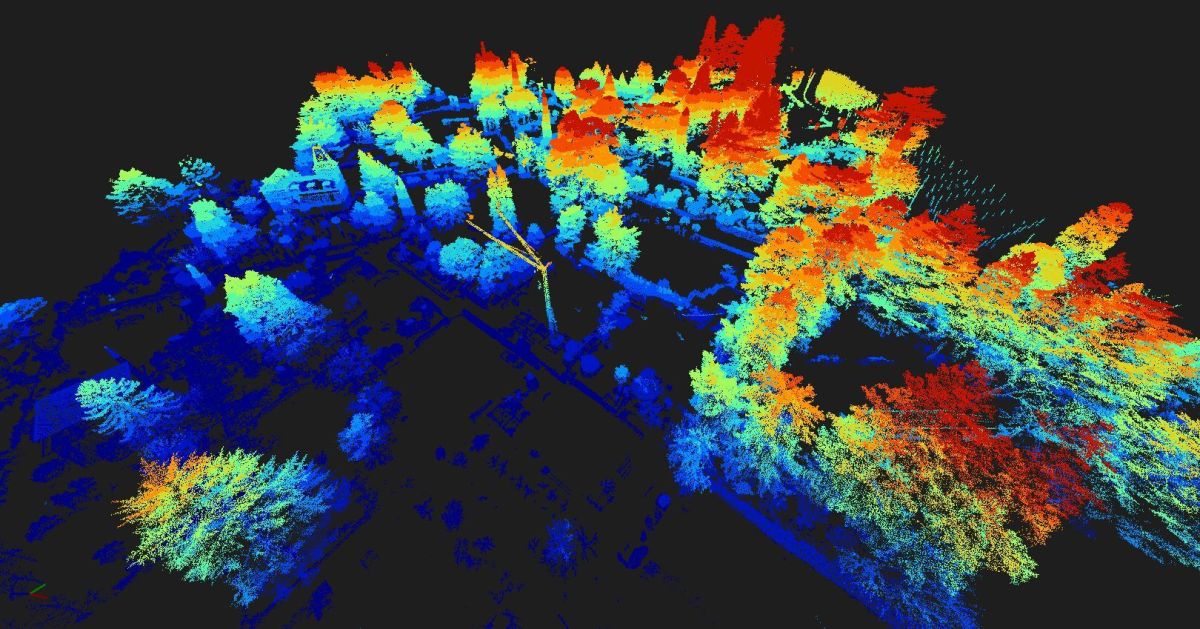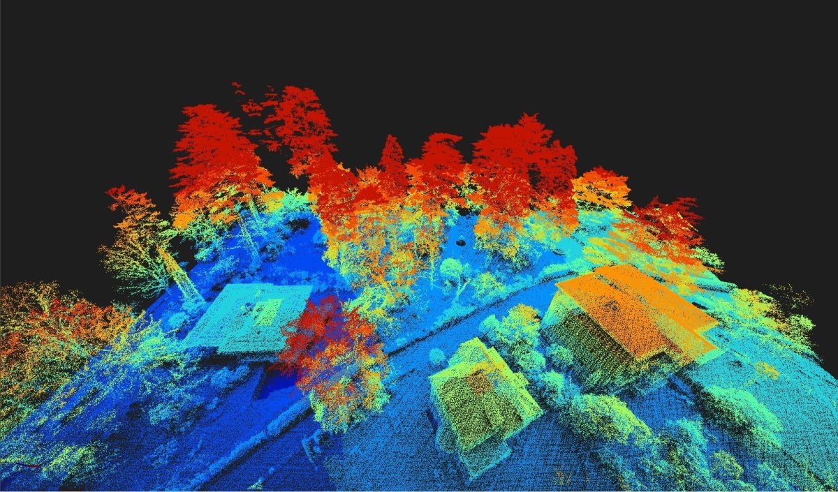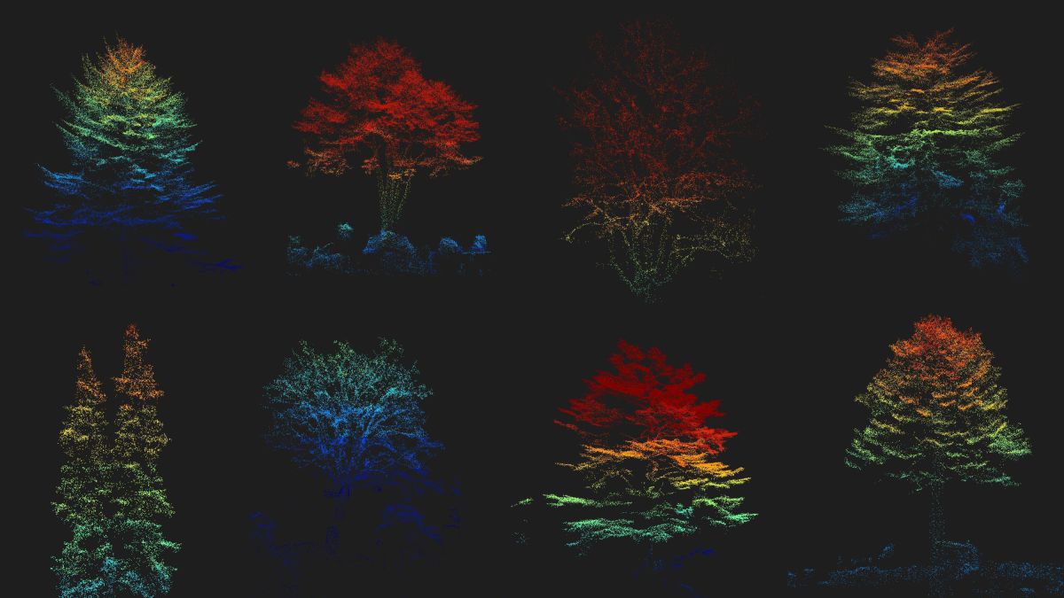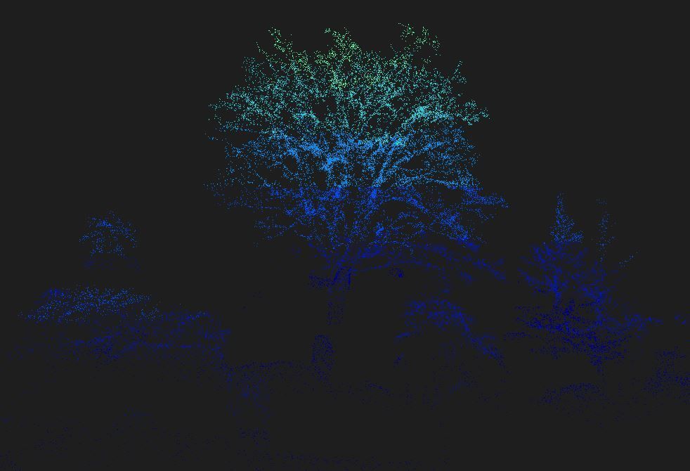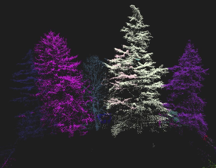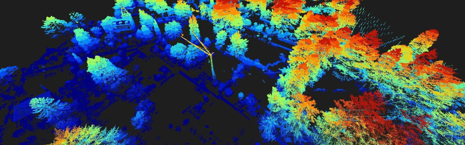
These beautiful photographs taken by a special laser technique (LiDAR) measure the historic tree population of Merano. No one knows for sure how many private trees are scattered around, how is their health and how they are facing the increasing heat and drought periods.
How it works: laser beams scan the survey area, recording spatial structures. The reflected beams produce point clouds, generating vast amounts of data. Through careful filtering and initial classification, the vegetation is sorted.
The goal? To create a complete inventory of private trees. Each tree will have its own digital twin—a 3D representation showing its characteristics and location. The digital twin opens up possibilities for simulating changing conditions and observing their effects, aiding decision-making in landscape and construction projects.
Thanks to the many contributors of this article: Barbara Baumgartner (Author), Anni Schwarz, Sonja Gantioler, and Marco Masin.
Photo credits: © | TS Photogrammetrie & Geoinformatik
To read the article click here