“Temperature differences are so high that families living in urban heat islands are increasingly paying more in utility bills to cool down their homes, compared to families living outside of such urban areas.”
This might not be much of a problem for people who can afford to pay more, he said, but it will increasingly become an unjust burden on those who are less affluent and will have to endure living in neighbourhoods that become unbearably heated up.
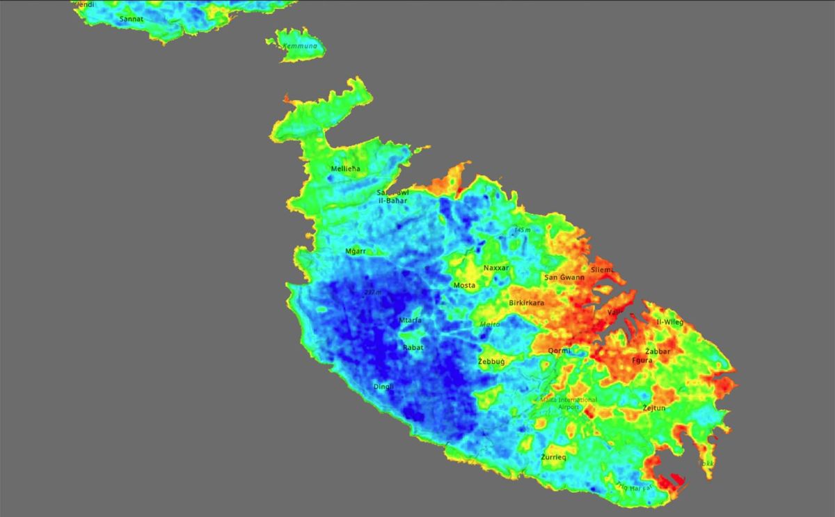
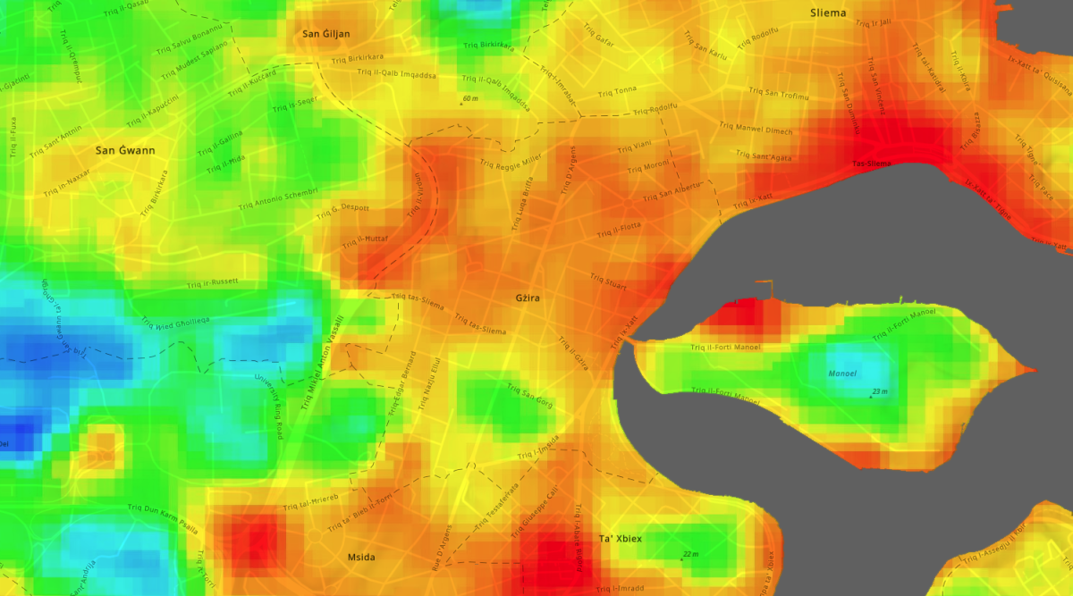
The data available on the application comes from two earth-observing satellites that are constantly orbiting the planet at immense speeds and pass over Malta every fortnight. They collect precise thermal data as they go.
RIU’s collaboration with USGS and NASA for night-time data comes from the recommendation the award-winning Maltese intellectual property PHASE 1 that seeks analyses of the Urban Heat Island at night to avoid the sun’s interference.
The satellites record temperatures across the islands and can detect temperature discrepancies every 30 square metres. The data is captured by NASA and USGS and is then transmitted to Gżira’s Research Innovation Unit and mapped out onto an interactive map.
An urban heat island is any area where heat generated from air conditioning units, vehicles, industrial buildings and other human activity is trapped and amplified, raising the temperature of that area significantly.
Despite its name, the phenomenon does not only occur on islands but is also common in most dense cities around the world.
Localities that lack open spaces and have poor master planning are particularly susceptible to heating up in this way. And in localities where high apartment blocks tower over both sides of a relatively narrow road, street canyons are formed, trapping heat between the dense buildings.
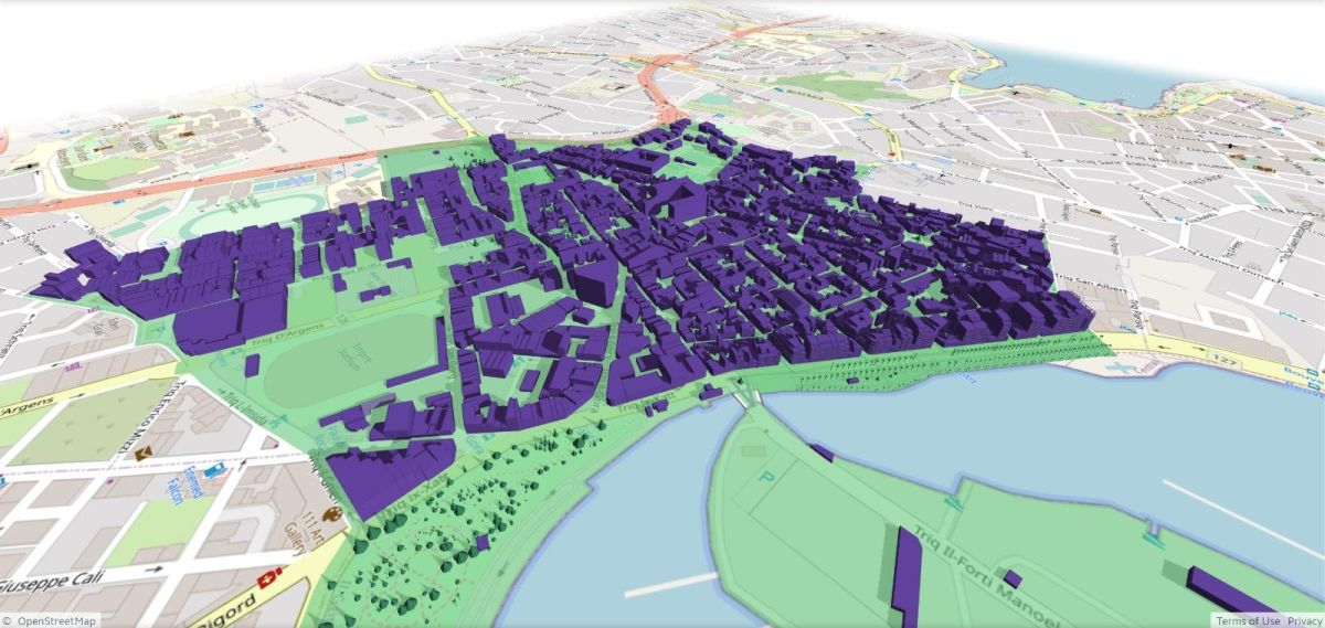
Borg said the Research Innovation Unit is also working on ‘The Digital Twin of Gżira’ – a feature that will be added to the application and will, among other things, allow prospective property buyers to calculate how much more expensive their utility bills will be if they opt for apartments in the urban heat island.
Borg first began studying the phenomenon of urban heat in 2015, after he noticed that recorded temperatures during summer were almost always significantly higher than those forecast in weather reports.
Borg said the Gżira council is so far the only one that has set up a research and innovation wing specifically focused on collecting data and analysing it to find climate-related solutions for the locality.
And mayor Conrad Borg Manché, who has been particularly vocal on protecting Gżira’s environment, said much more can and must be done.
“Real, long-term solutions require that we collect accurate data, and that is why we invested in this project,” he said.
“We are using this data to reimagine Gżira with new urban planning projects that would reduce excessive heat.”
There are 5,000 parked vehicles in Gżira and another 40,000 vehicles go through the locality’s streets daily, he said, and one of the solutions is to shift almost all parking underground and use the newly acquired street space to widen the pavements and plant as many trees as possible.
“That is part of our vision for Gżira, because trees significantly cool down any environment,” he said. “I know it’s not easy and it will take time to fundamentally change our present urban planning, which was designed almost solely for cars. But we need bolder, longer-term solutions like this one if we want to see some real change in the future.”
The Malta Urban Heat Island App can be accessed on https://arcg.is/0rrPTS.
And the website of the Research Innovation Unit is https://riu.gov.mt.
News source: The Gżira road that is 11°C hotter than a nearby valley (timesofmalta.com)
Author: Mark Laurence Zammit